Duration: 1 hour 45 mins
Distance: 7.5kms (4.5 miles)
Total Ascent: 120m
Difficulty: Easy
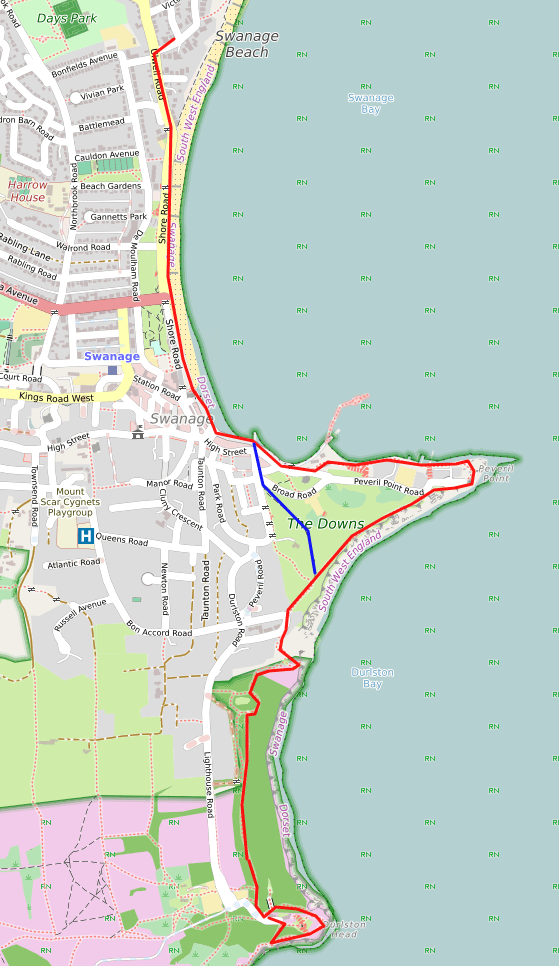
Swanage sea front, cliff and woodland walk to Durlston Castle
From The White House turn right onto Burlington Rd then left on Ulwell Rd to join the South West Coast Path in the direction of Swanage town centre. Continue along the seafront promenade through the town until you approach the old pier. The route goes up Peveril Point Rd and soon bears left on an elevated path behind the sailing club before dropping down on to the small beach. Proceed with care along the rocks as they can be slippery after high tide, passing the Wellington Clock Tower – brought stone by stone as ballast in the returning quarry ships from London – followed by the inshore fishing boats and lobster pots, and then the recently rebuilt Swanage RNLI lifeboat station. Before Peveril Point is reached the path goes up a set of stone steps to the NCI Coastwatch station. [Note that if the weather is bad or the tide is high, this last section can be avoided by continuing up Peveril Point Rd to the Coastwatch station]. At Peveril Point evidence can be seen of WWII observation and gun positions which helped to defend Southampton Water to the west of the Isle of Wight.
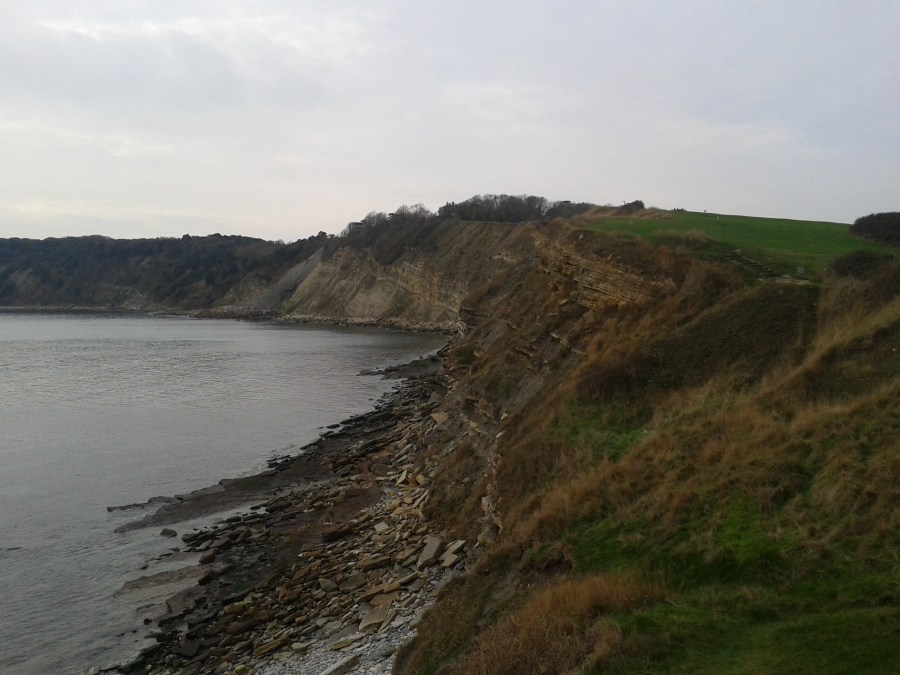
From Peveril Point follow the coast path along the line of the cliff up to where The Downs meets Belle Vue Rd, with signs of quarry ship ballast in the form of City of London bollards. Turn left and look for the South West Coast Path sign that takes you down a set of steps between blocks of flats, through a small wood and turning right back up to join the wider walled promenade track built as part of tourism growth during the Victorian era. This track to Durlston Castle is known as the Isle of Wight Rd, but today the growth of the trees has obscured the view of the island for the most part. Continue on this pleasant woodland track climbing gradually towards Durlston Head and the castle.
As you reach Durlston Castle an option is to take the clifftop coastal path that heads left and circles around the castle, and from where you can either head up past the globe to take a look around the displays, webcams and exhibitions in the Durlston Country Park visitor centre or stop for a coffee, or to continue westwards on the coast path. [Note that you are now at the start of the Durlston Head to Dancing Ledge walk, which gives the option of extending your walk for example around the Anvil Point lighthouse before heading back towards Durlston Castle.] To return to Swanage the most scenic route is to retrace your steps. When you reach The Downs an option is to cut the Peveril Point corner by walking across the grass slope (marked in blue on the map) in the direction of the Broad Rd car park.
