Explore heathland & sand dune tracks before returning along the shore with views to Old Harry Rocks
Duration: 90 mins – 2 hrs 30 mins
Distance: 4 – 6 kms (2.5 – 3.7 miles)
Total Ascent: 15m
Difficulty: Easy
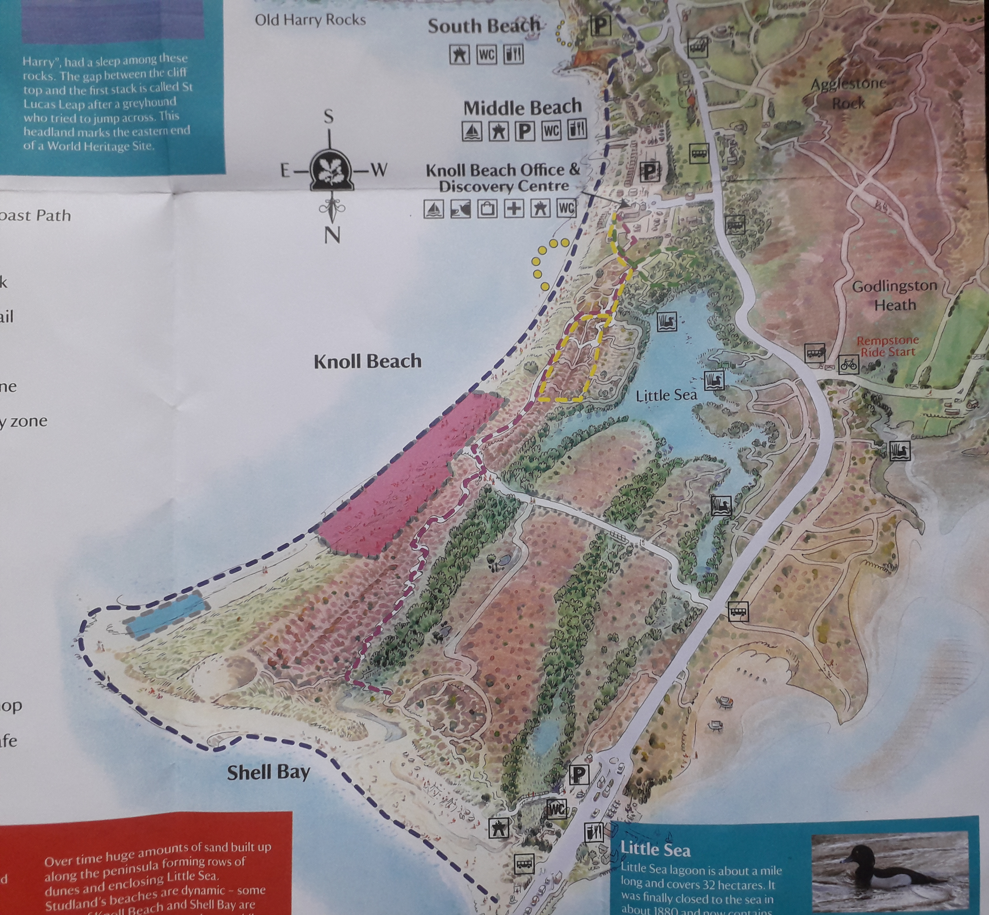
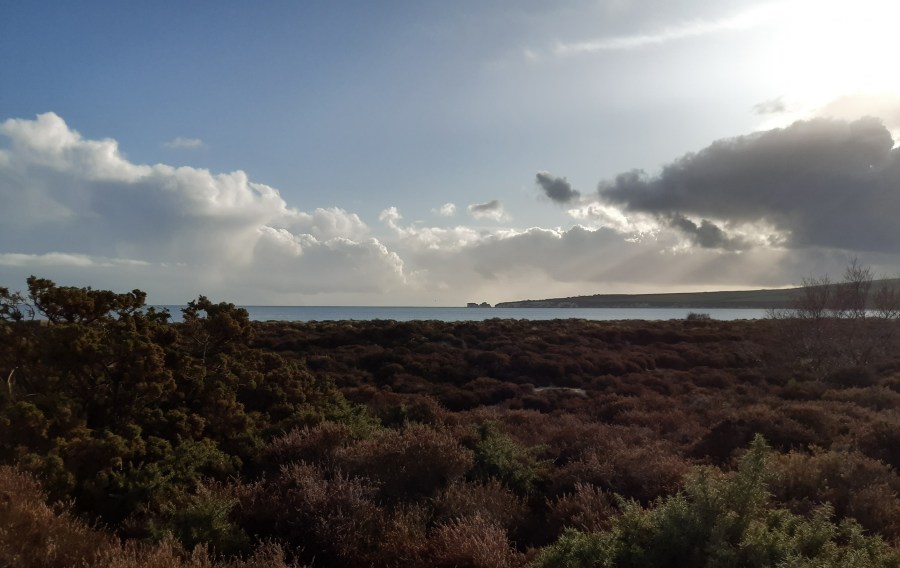
Studland beach and the circular walk through sand dunes is a great location for a brisk winters day walk or on days when the weather is far from clement. The northern end of the beach is located at the entrance to Poole Harbour and the Sandbanks ferry, the starting point for the South West Coast Path, UK’s longest trail, ending at Minehead some 630 miles away. From here the beach runs south for approximately 4 miles to the village of Studland. There are various access points to the beach from one of the National Trust car parks at Shell Bay, Knoll Beach, Middle Beach and South Beach, or if space is available parking along parts of Ferry Road.
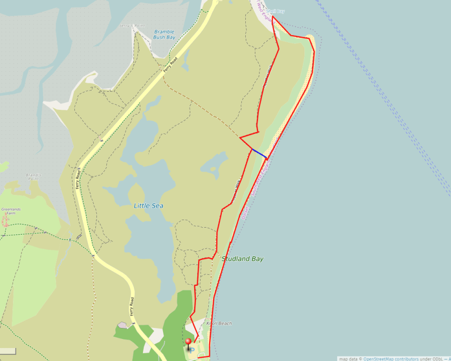
This circular walk from Knoll Beach takes you through National Trust heathland and sand dunes before returning along the Studland Bay shore. Knoll Beach has a toilet block and is home to the National Trust shop and cafe, though check on their website to see what is open particularly during the Covid-19 restrictions. Note that this walk also goes through the Studland naturist area which is clearly marked by signs along the way.
Knoll Beach car park is located off the Studland to Sandbanks Ferry Road opposite the Knoll Beach hotel. Driving down to the beach select the car park on the left (marked with the pin on the map above) as you will be commencing the walk behind the dunes at the north end of this car park. To help you get started the National Trust have provided a map and information leaflet for a shorter 30 minute walk through the dunes. However our suggestion goes further to give longer one & half or two & half hour options.
At the beginning the heather / sand dune trails are well defined, but the further you progress the paths become less obvious and more of a sandy track between the heather. Look out for the yellow (sand dunes trail) and purple (heather walk) marker posts to guide you (see map above left), but part of the fun is picking your way up and down the dunes, and from time-to-time doubling back when you realise you have made a mistake! Just keep the sea on your right, but do not be mistaken by the Little Sea lagoon on your left! Eventually a more well defined path running parallel to the coast will be encountered and you follow this and the purple markers as far as the Ferry Rd/beach access track which cuts across at right angles. To choose the shorter version of this trail turn right here (marked in blue on the map above) and upon reaching the beach turn right and this will take you back along the shore to Knoll Beach and the car park. For the longer walk turn left on this access track and then take a right footpath, again following the purple heather walk. Continue on this track which, after crossing a small footbridge, brings you out onto Shell Bay, with Sandbanks across the water. Turn right, passing the largest dune on the end, and begin your beach walk southwards and back towards Knoll Beach.
