Spectacular ridge and cliff top views on this MOD range walk to the WWII abandoned village of Tyneham
Duration: 3 hours 45 mins
Distance: 14 kms (8.7 miles)
Total Ascent: 400m
Difficulty: Moderate
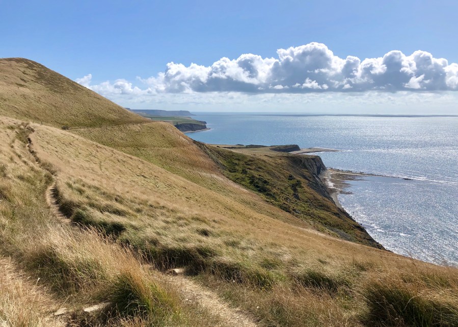
Taking advantage of the two ridges that arc inland from the coast this is probably our number one walk in the Isle of Purbeck, providing magnificent views along the coast from St. Aldhelm’s Head to Portland Bill. This walk takes you onto the Ministry of Defence Lulworth Ranges which are used for weapons training, and as a result you need to double check via the link that the range walks – and the roads across – are open. As a guide the ranges are open every weekend (with the exception of six throughout the year), Bank Holiday weekends, plus extended periods during summer and over Christmas & New Year. Note that when walking across the ranges keep between the yellow markers.
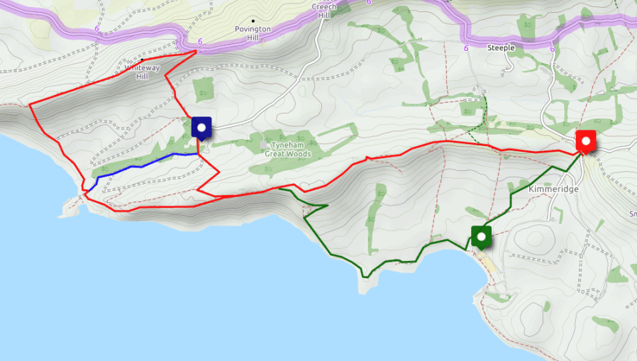
Take the road to Corfe Castle and turn left off the A351 immediately behind the castle where you will also see signs informing whether the ranges are open or closed. Continue on this B road through Church Knowle until you see the sign to Kimmeridge where you turn left. After you climb and come over the crest look out for the car park on the left which is situated just after a minor road in an old quarry (marked red on the above map). This free car park is popular and if full you will need to drive down to the main car park in Kimmeridge Bay (marked green) where there is an access charge of £5. If the latter proves to be the case then starting off on the green route along the South West Coast Path is your best option.
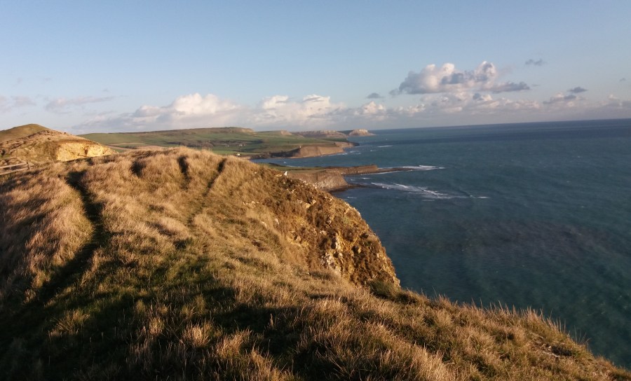
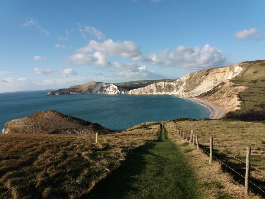
From the Quarry car park cross the road and take the right of the two gates that heads across the ridge line [Note the left gate takes you down the hill to Kimmeridge village and then the bay as shown by the green route and as used in the Swyre Head to Kimmeridge walk]. Keeping on the ridge you have great views down onto Kimmeridge Bay with Clavell Tower on the left hand side. As you pass along the ridge look out for the footings for WWII radar masts and huts that were used to scan for German E-boats. Eventually you will arrive at the highest point, Tyneham Cap, and the views now open up to show the rocky face of Gad Cliff and the chalk cliffs around Lulworth. As the path descends it merges with the South West Coast Path by the stone seat, which you now follow across the top of Gad Cliff before descending into Worbarrow Bay. At this point and with a good view of the challenging hill to come, you have the chance of turning right and taking the shorter blue option along the track to Tyneham and then back [At the corner by the toilet block and Tyenham Farm Museum, take the footpath through the gate and proceed across the field to the top of Gad Cliff where you can commence your walk to the car following either the red or green options].
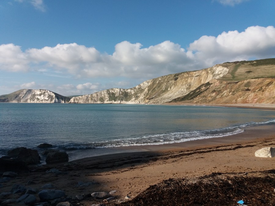
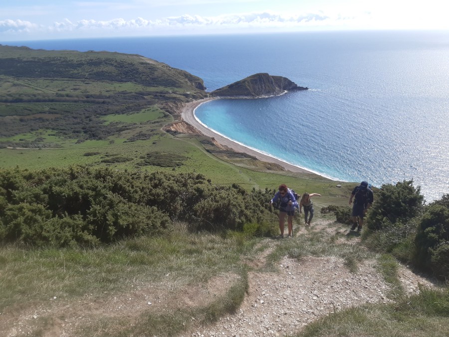
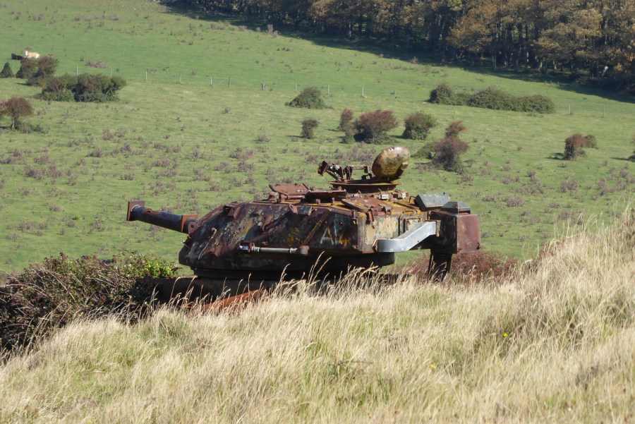
In Worbarrow Bay the coastal path dips down to the beach before starting its ascent, gradually at first but then steeply to the top of the chalk ridge upon which sits the Flower’s Barrow Iron Age hill fort. Sections of the double and triple ramparts can still be seen though some of the southern facing walls have been lost over time due to cliff erosion. This point on the walk is frequently a welcome stop for a packed lunch or drink. Looking west the coastal path dips into Arish Mell and then rises up Bindon Hill, behind which a number of disused army vehicles can be seen that are used for firing practice from Lulworth Camp that can also be seen to the right. Commencing head eastwards along the ridge which continues for 13 miles all the way to Ballard Down and Swanage. Pass the Trig point on Whiteway Hill and descend to the point where the road meets the path and take the track on the right that leads diagonally down the hill towards the village of Tyneham.
Tyneham Village was evacuated in 1943 during WWII but has never been re-inhabited. The houses are now just shells, but on the walls there are pictures and information boards telling us about the former dwellers. You can look around the church and school, the latter having the children’s books laid open on their desks [note at the time of writing the building was closed due to Covid-19 restrictions]. Pass through the car park (marked blue on the map) along the track to the corner with the toilet blocks and Tyneham Farm Museum on the left, pass through the gate ahead and zig-zag up the side of the hill to the top of Gad cliff where you can retrace your steps back to the car via either the red or green routes. [Note if you are feeling fresh and looking at returning to the Quarry car park via the green route, the path that takes you back on to the ridge from Kimmeridge Bay is the reverse of the instructions found in the Swyre Head to Kimmeridge walk].
