Spectacular all day cliff and ridge walk between the MOD Lulworth Ranges and Corfe Castle
Duration: 7 hours
Distance: 26 kms (16 miles)
Total Ascent: 770m
Difficulty: Strenuous
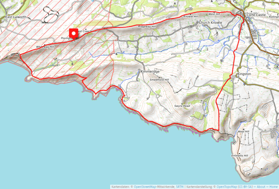
If the Isle of Purbeck eastern ‘circular’ walk is more like a square, then the western circuit resembles a triangle or wedge. Both walks share the cross-route between the coast at Kingston and the Purbeck Hills ridge at Corfe Castle, but here the western circuit southern section follows the South West Coast Path past Kimmeridge and Tyneham, and the northern side the Purbeck Hills ridge from Flower’s Barrow to Corfe Castle. Before commencing this walk remember to check that the MOD Lulworth Ranges are open (hash marked area on the map).
From Swanage the closest place to start is either Kingston or Corfe Castle, but given that options for food and drink refuelling on this long walk are limited, a recommendation is to start further west. From Corfe drive behind the castle and past Church Knowle and Kimmeridge, before heading for the Tyneham View car park situated on a high point of the ridge (red marker on map). By walking in an anti-clockwise direction the Scott Arms pub in Kingston or the village of Corfe Castle will provide the opportunity for a lunch or mid-afternoon break. However note that the car park is on MOD land and is locked from dusk to dawn.
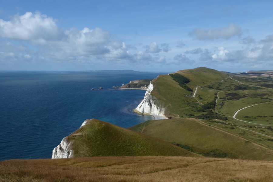
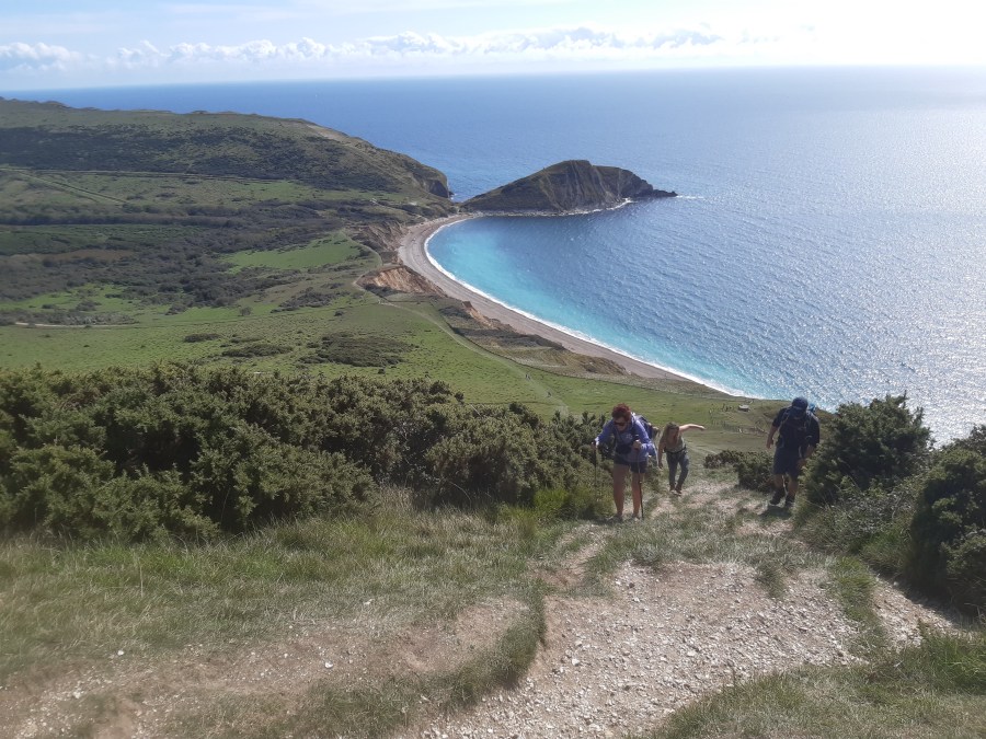
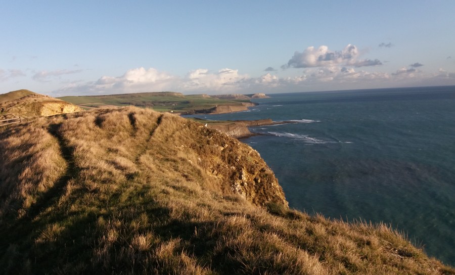
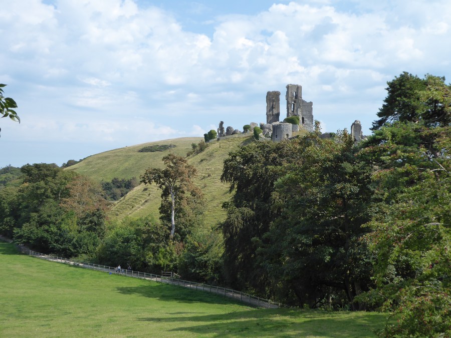
With great views all around, head west from the car park along the footpath that runs parallel to the road, making sure to always keep within the yellow range walk marker posts. As the road bears to the right, keep straight on, crossing the track that leads left off the ridge to Tyneham village. You are now on the Kimmeridge to Tyneham walk, though going in the opposite direction to that described. Where the ridge meets the coast at Flower’s Barrow Iron Age fort, turn left down the steep hill and begin the walk eastwards along the coastal footpath. After completing the Kimmeridge to Swyre Head coastal path keep straight on climbing the steep slope to the top of Houns-tout Cliff. At the top fine views back to where you have walked can be enjoyed before heading north and inland with the Encombe House estate below on the left. The footpath enters a wood before exiting onto the road by a car park. Turn right to the village of Kingston, where a good spot for a drink or lunch can be found at The Scott Arms with fine views over towards Corfe Castle and the next phase of your walk.
The route from Kingston to Corfe Castle follows the Hardy Way. Look for the footpath signs and track that forks off the road at the western end of the village, opposite St. James’s Church, then take the footpath right onto a track, next the footpath left which takes you downhill across the valley before climbing again onto the open ground of the National Trust’s Corfe Common. Leave the common on the outskirts of Corfe Castle village, heading north along West Street to the centre of the village where there are plentiful pubs, shops etc for food and drink. Continue through the village and with the castle on your right walk down the alley, crossing the road and then head up onto the ridge. Continue along the ridge, crossing the East Creech to Church Knowle road in the dip, and later passing the National Trust’s Grange Arch on your right. At the junction with the next road you will be re-entering the MOD Lulworth Ranges. Keep following the ridge path between the yellow markers back to the car park.
